This post may contain links to products that we use and love, and we may earn a commission at no cost to you.
Hiking during the winter in the Eugene / Springfield area is tricky with young children. They need fresh air and exercise, but everything is wet, or muddy, or wet and muddy. Thankfully, we have some great hiking trails that are perfect during the winter, and stroller-friendly, too.
Eugene is central to lots of great hiking and we are building our list of our favorite winter hikes for kids near Eugene. Our criteria is pretty simple:
- Each hike must be within 30 minutes of Eugene (we measure from Starbucks on Gateway because it’s somewhat centrally located between Eugene and Springfield, and also, don’t all adventures start with coffee?)
- It must be stroller-friendly (i.e. no mud!)
- And above all, it must be engaging for kids.

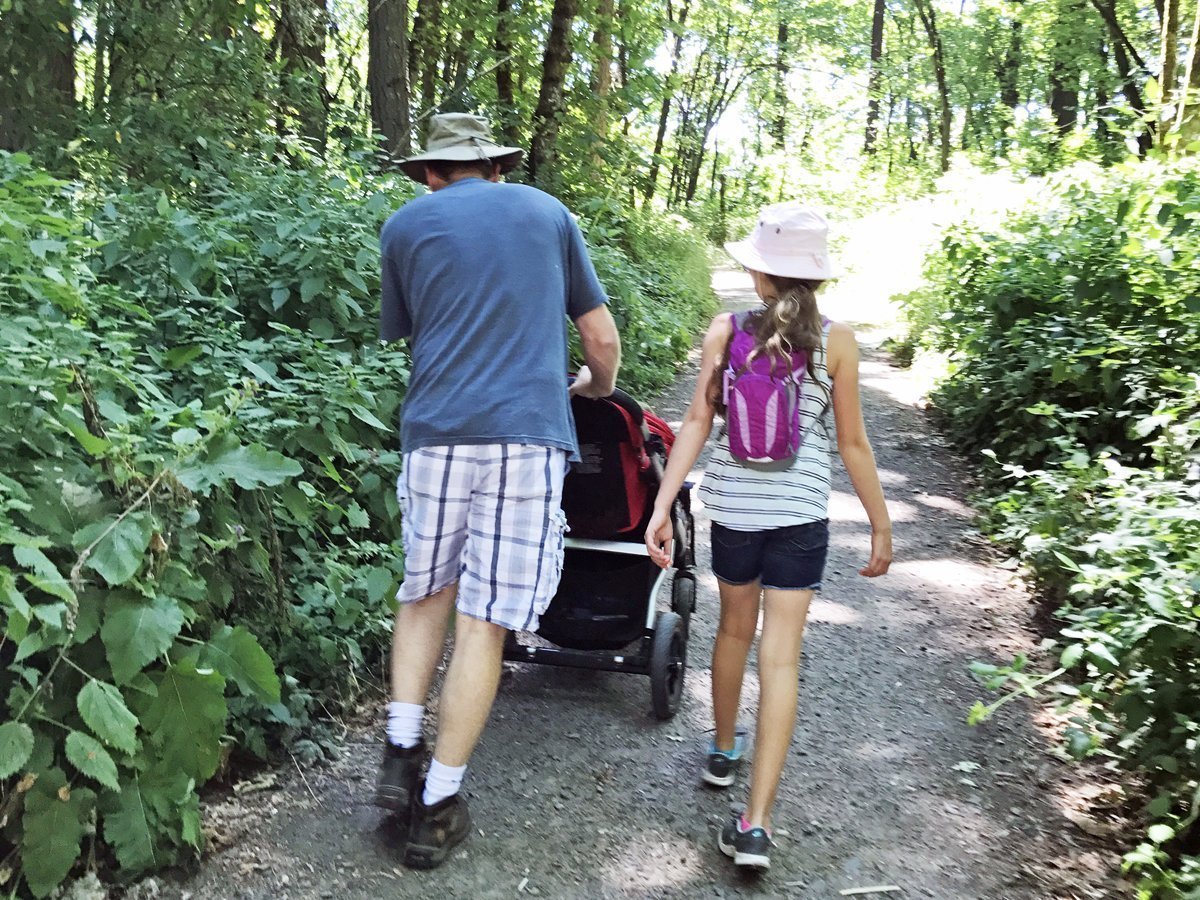
This was a great trail, but too muddy. Our stroller handled it fine, but putting it back in the van was…gross.
Also, let me note that I use the word “hiking” very loosely! If you’ve ever hiked with young kids, then you know it’s more like a very slow walk with lots of breaks for checking out rocks, slugs, and wandering off the trail. And while we love and often use our baby carriers, there are occasions when using a stroller is preferable, so wide trails that aren’t muddy are ideal.
Dorris Ranch
Dorris Ranch is located right in Springfield and has many options for stroller-friendly winter hikes. As a historical orchard, Dorris Ranch is open year round for families to walk the roads between the hazelnut orchards. There are lots of paths, or you can forge your own, winding between the rows of trees. We tend to aim for the historic tractor and farm buildings located in the center of the orchard. Then on our way back to the car, we often explore new routes and zigzag between trees.

Okay, so this isn’t winter time, but this is a trail at Dorris Ranch that is easily navigable by strollers during the winter.

Continuing through the orchards, the trail leads to the river. There’s a picnic table here, a lovely spot to rest or have lunch.
Let’s go!
Address: 205 Dorris St, Springfield OR 97477
Distance from I-5 at Eugene/Springfield: 2.9 miles, or about 10 minutes.
Middle Fork Path
While you’re at Dorris Ranch, check out the Middle Fork Path. There’s a trailhead for this fantastic walking and biking path from the east end of the parking lot at Dorris Ranch. This path is paved, so it’s perfect year round for strollers, wheelchairs, and bikes. Watch the landscape change as you walk toward the river. First, you’ll pass the Living History Village at Dorris Ranch. Take a few minutes and walk that short loop, and imagine what life was like 150 years ago.

The path around the interpretive village is graveled, so it’s passable with a stroller even on the rainiest days.
After the village, head down the paved path toward the river. You’ll pass through broad oak savannas, restored to what was typical in the Willamette Valley before the mid 1800s. These grassy areas are dotted with groves of oak trees that are beautiful in the summer or winter, and you’ll enjoy unfettered views of nearby hilltops. Continue through a conifer forest filled with fir trees until you see the Willamette River. Walk along the river; it’s wider here since two forks of the river meet. During the right season, you might even see boaters. Wave and say hi!

The entire Middle Fork Path is 4 miles long, from Clearwater Park to Dorris Ranch. But there are plenty of turnaround points, so walk for as long as you want, then turn back!
Let’s go!
Address: 205 Dorris St, Springfield OR 97477
Distance from I-5 at Eugene/Springfield: 2.9 miles, or about 10 minutes.
Mill Race Path
Connected to the above Middle Fork Path, the Mill Race Path is not one to miss! Part of Springfield’s new paved walking/bike path system, the Mill Race Path has two trailheads, one at the west end at Booth-Kelly and one in the middle on Jasper Road. We use the trailhead and parking at Jasper Road and we’ve explored the trail in both directions from there. One way leads South to the Willamette River and the Middle Fork Path. The other way leads west along the mill race. Our favorite is south, to the Middle Fork Path, but both directions give unique views of the mill race and surrounding landscapes. The west part of the path borders the train tracks for a little while and my kids were super fascinated by that. The entire 3-mile path is paved, so it’s great for keeping stroller wheels and little feet clean during the rainy winter months.

Our stroller is built for hiking, but no one wants muddy wheels in the van! And in the winter, when we really need out of the house, the Mill Race Path is nearby and mud-free.
Let’s Go!
Directions: Booth-Kelly Trailhead, 307 S. 5th St.
Jasper Road Trailhead, 3202 Jasper Road
Distance from I-5 at Eugene/Springfield: 3.2 miles, or about 11 minutes to the Booth-Kelly trailhead. 5.7 miles, or about 16 minutes to the Jasper Road trailhead.
Mount Pisgah Arboretum
Every list of hikes near Eugene includes Mt Pisgah, and for good reason. With over 7 miles of trails within the arboretum, there’s a trail for everyone. Take the 1 mile hike to the top for incredible valley views, or hike through the forested hillsides for shade and quiet. Hike along the river and throw rocks into the water, or visit the bird blind interpretive center. There’s even a hike to a hilltop with a swing. Flat, steep, broad, or narrow, trails at Mt Pisgah traverse the grasslands, the oak savannas, and the forest. It’s like a choose-your-own-adventure park, and every visit can be an entirely different experience. Many of the trails are accessible for both wheelchairs and strollers, so everyone in the family can enjoy the unique features of Mount Pisgah Arboretum.

On the Water Garden Trail, you’ll find the Wetlands Exhibit, a bird blind with interpretive signs. My kids loved exploring this area and interacting with the Q&A signs.

Even our 5-year-old was fascinated with the Wetlands Exhibit, and fully engaged as he explored the signs and photos.
Let’s Go!
Directions: From Interstate 5, Southbound: Take Exit 189. At the base of the offramp, turn right and head toward 30th Avenue. Make a left turn at the stop light at 30th Avenue and cross over the freeway. At the 4-way stop sign just past the overpass, turn left. Make a right turn onto Franklin Blvd at the Shell Station, and cross under the railroad bridge. Follow Franklin around a curve, then turn left on Seavey Loop Road. Continue for about a mile and a half. Cross a short bridge over the river. Follow the right fork of the road into the Arboretum parking lot.
Distance from I-5 at Eugene/Springfield: 9.5 miles, or about 20 minutes.
Jasper State Recreation Site
Definitely a winter-time favorite, partly for the 1-mile loop that is either paved or bark mulched, and partly because no one else ever seems to go there in the winter. Jasper State Recreation Site is closed to vehicle traffic in the winter, but there’s a parking lot outside the gate. There’s no charge in the winter, and you’ll have the park to yourselves, including the playground. It’s a great place to let the kids roam. Play on the playground if it’s dry enough, or bundle up for a winter picnic.

We often enjoy a winter hike along the river at Jasper State Recreation Site. A trail follows the entire length of the park along the river and then loop back on the parking lot for a stroller-friendly 1-mile hike.
Let’s go!
Directions: Take OR-126 through Springfield to Bob Straub Parkway and turn left on Jasper Road. Turn right at the bridge in Jasper onto Parkway Road. After 1 mile, watch for signs and turn left on Jasper Park Road to the gates at Jasper State Recreation Site.
Distance from I-5 at Eugene/Springfield: 11.7 miles, or about 20 minutes.
Fall Creek Lake
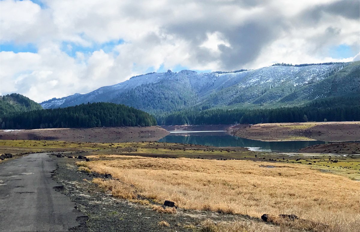
Squeaking in under our deadline at around 25 minutes from Eugene, Fall Creek Lake offers an amazing winter hike. The Army Corps of Engineers drains the lake during November and December, and then for a few weeks in January and February, it’s empty! There’s an old highway under the water that’s exposed during these months, so you can even take a stroller to the bottom of the lake! It’s maybe the most unique hike on our list, and you won’t find it in any guidebooks.
Take a grocery bag for treasures. My kids found quartz and jasper rocks, old bolts galore, and even a baseball batting glove. We threw away most of our “treasures”, but kept the rocks.

The road on the left is part of a pre-1965 highway and is now underwater most of the year. But it’s easy to take a stroller all the way to the bottom of the lake.

Follow the road down far enough, and you’ll find an old parking lot. I haven’t been able to find out why this exists. One theory is that it’s from when the dam was built. Another is that it used to be for recreational parking when the water is low. Anyway, it was the perfect spot to park the stroller and let the littles out to roam.
Let’s Go!
Directions: Take Hwy 126 through Springfield. Hwy 126 becomes Bob Straub Parkway, follow that to a left on Jasper-Lowell Road. Follow Jasper-Lowell road to Big Fall Creek Road. Turn left and follow to North Shore boat ramp, just past the dam.
Distance from I-5 at Eugene/Springfield: 17 miles, or about 25 minutes.
Elijah Bristow State Park
I hesitated to included Elijah Bristow, because most of the trails are pretty muddy in the winter. But ultimately, it’s our favorite state park and all of the roads are paved, so if you don’t want to risk a muddy trail, you can stick to the paved roads and still have a glad-we-went winter experience. Elijah Bristow is on the edge of our 30-minute boundary at 27 minutes, but there are so many trails (10 miles!) and so much to see. If you chance the trails, you can walk along the river, or along meadows, or to see a beaver dam. Each trailhead has something different to offer, and all of the trails are technically stroller-friendly, but also tend to have muddy spots during the winter.
Fun history fact: Elijah Bristow State Park is named for, you guessed it, Elijah Bristow, who was the first pioneer in this area and founded Pleasant Hill in 1846.

Trail’s end (or perhaps the beginning for you!) at Elijah Bristow State Park.
Let’s go!
Directions: Hwy 58 to a left on Rattlesnake Road. Then right on Wheeler Road to Elijah Bristow. Go to the second entrance; the first is for horse trailers.
Distance from I-5 at Eugene/Springfield: 17.7 miles, or about 27 minutes.
But what about…?
Our list isn’t exhaustive or complete. We’ll add to this as we explore more trails. If you have a favorite hiking trail that meets our criteria, let us know!

2 comments
These are all such pretty family trails. Thanks for sharing.
Thank you! We do have lots of lovely trails. And we love seeing other families enjoy them, too!