
This post may contain links to products that we use and love, and we may earn a commission at no cost to you.
It was deep into January and our family needed a new adventure. My husband brilliantly suggested we visit an empty lake. Every year, Fall Creek Lake is drawn down to the historic stream level. In other words, they open the dam and empty all the water so just the natural stream is flowing. The Army Corps of Engineers draws down the lake to improve passage for juvenile salmon. As a result, the lake is very low during the fall and winter months.

Our daughter checks out the colorful view over {empty} Fall Creek Lake. This is from the top of the dam.
Fall Creek Lake
Hiking to the bottom of Fall Creek Lake met our criteria for an interesting family hike. After all, just imagine what you can find at the bottom of a lake! We weren’t sure about the stroller, but as it turned out, we were able to take the stroller all the way to the bottom, which was nice for our toddlers.
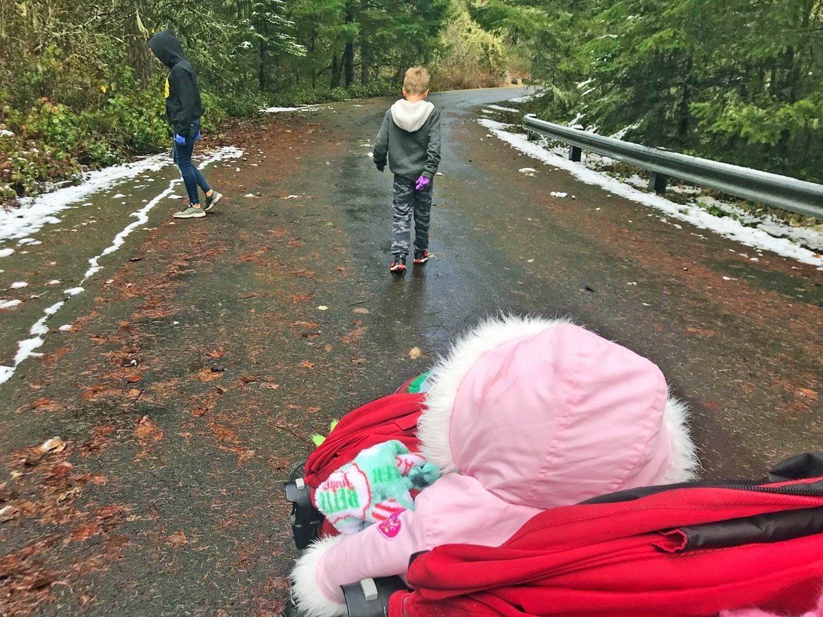
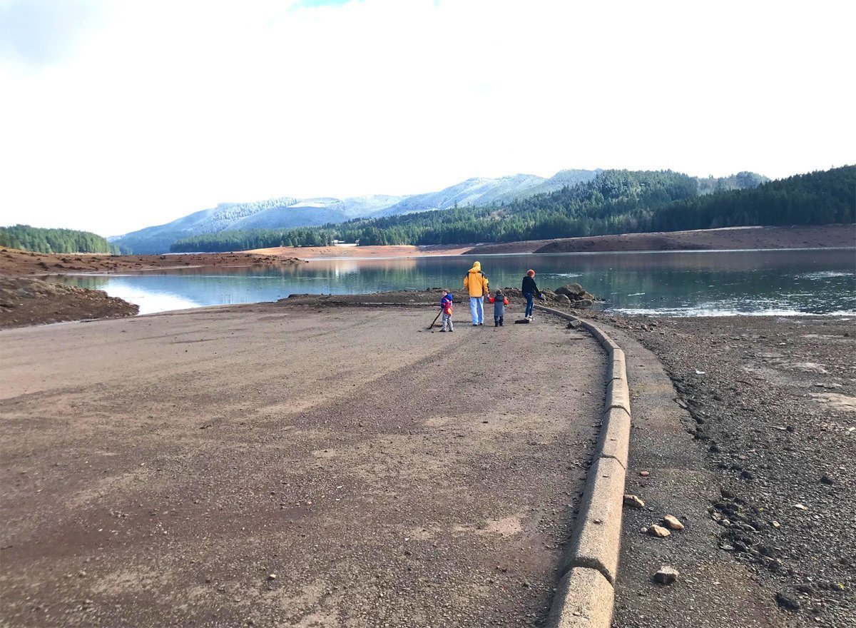
We parked at the gate at the North Shore entrance. First, we checked out the dam. And what to our wondering eyes would appear? A paved road to the bottom of the lake! We unloaded the stroller and off we went. Past the gate is the usual parking area, with picnic tables and vault toilets (which are usually locked in the winter but thank goodness one was open this time!) And past that trailed a paved road, down, down, down to the bottom.
Road to the Bottom

Was this an access road while the dam was being built? Or a bit of an old highway? We were grateful for a non-muddy way to reach the bottom, especially with our two toddlers who are 20 months old.
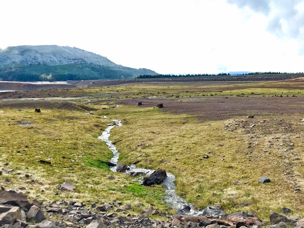
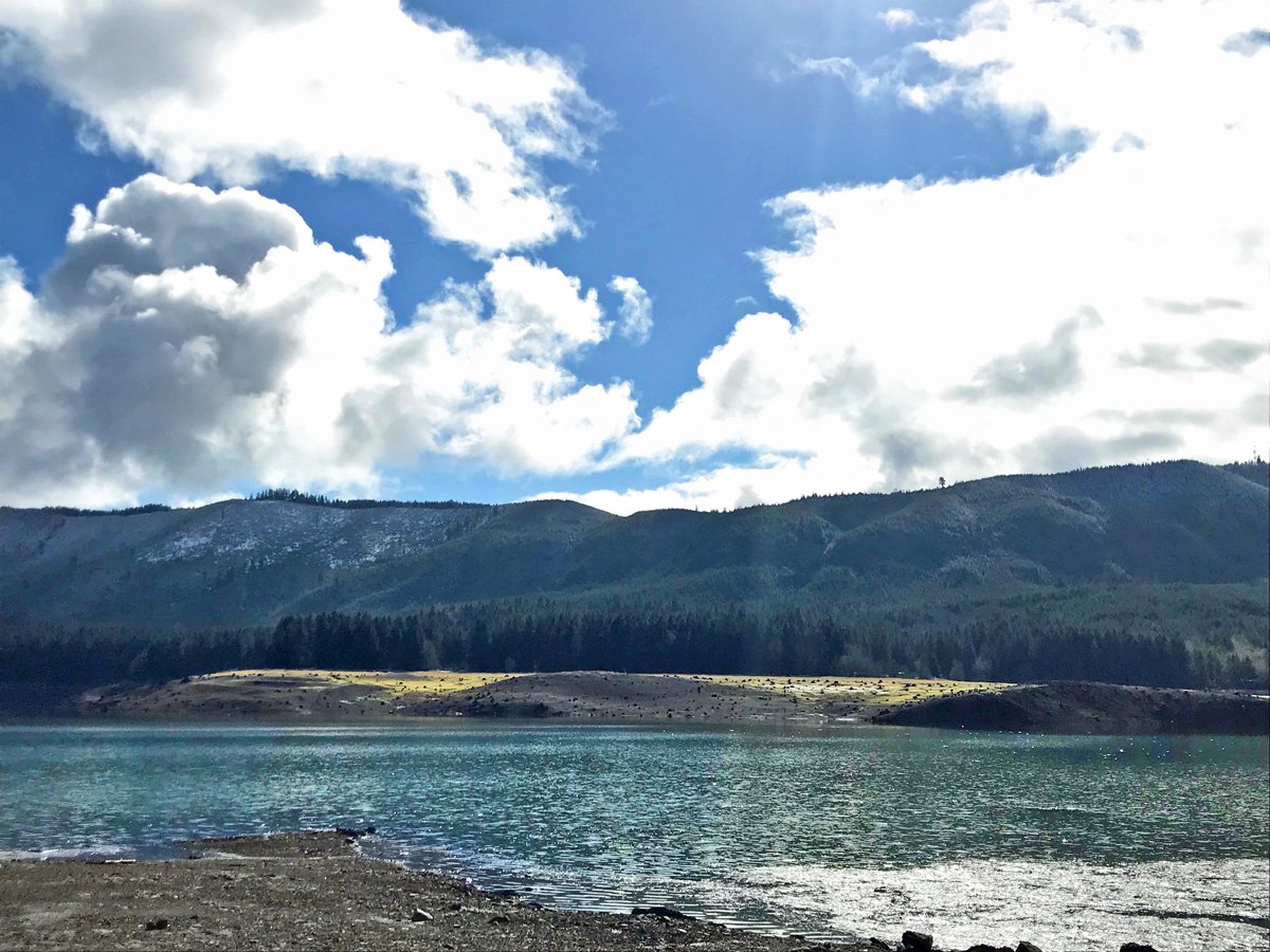
The scenery was like a crayon box. A bit of snow on the hills, the astonishingly green moss, the pastel grasses, and the sometimes-blue sky reflected in the water below. I took dozens of photos as I marveled at all of the colors, far more than I expected for the bottom of a lake.
This panorama was irresistible on such a glorious day. The sun peeked out of the clouds, along with cerulean sky. The moss was verdant green. Even the rocky exposed soils wore a hint of red.
My older kids set off to explore, and it was easy to keep them in sight almost anywhere in the lake basin. Stumps abound, along with small rivulets of water streaming toward the lake.
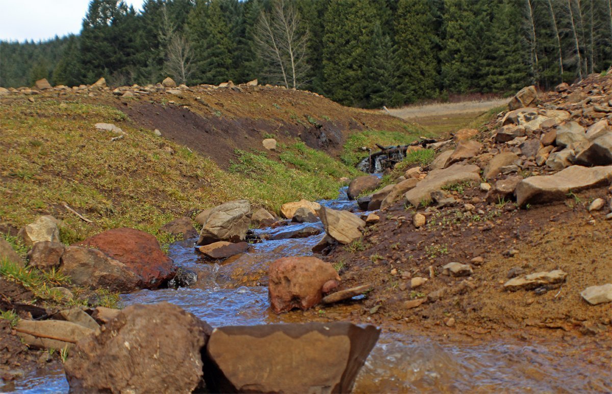

Tiny rivers, brilliant colors…what’s not to like?
Is this really Oregon?
At one point on our hike, I parked the stroller and looked around. I’ve never been to Ireland or Scotland, but the landscape of the Fall Creek Lake reminds me of Ireland in the movies. Thick green mosses with boulders and stones peeking above, and the sound of water trickling. Was this really Oregon?
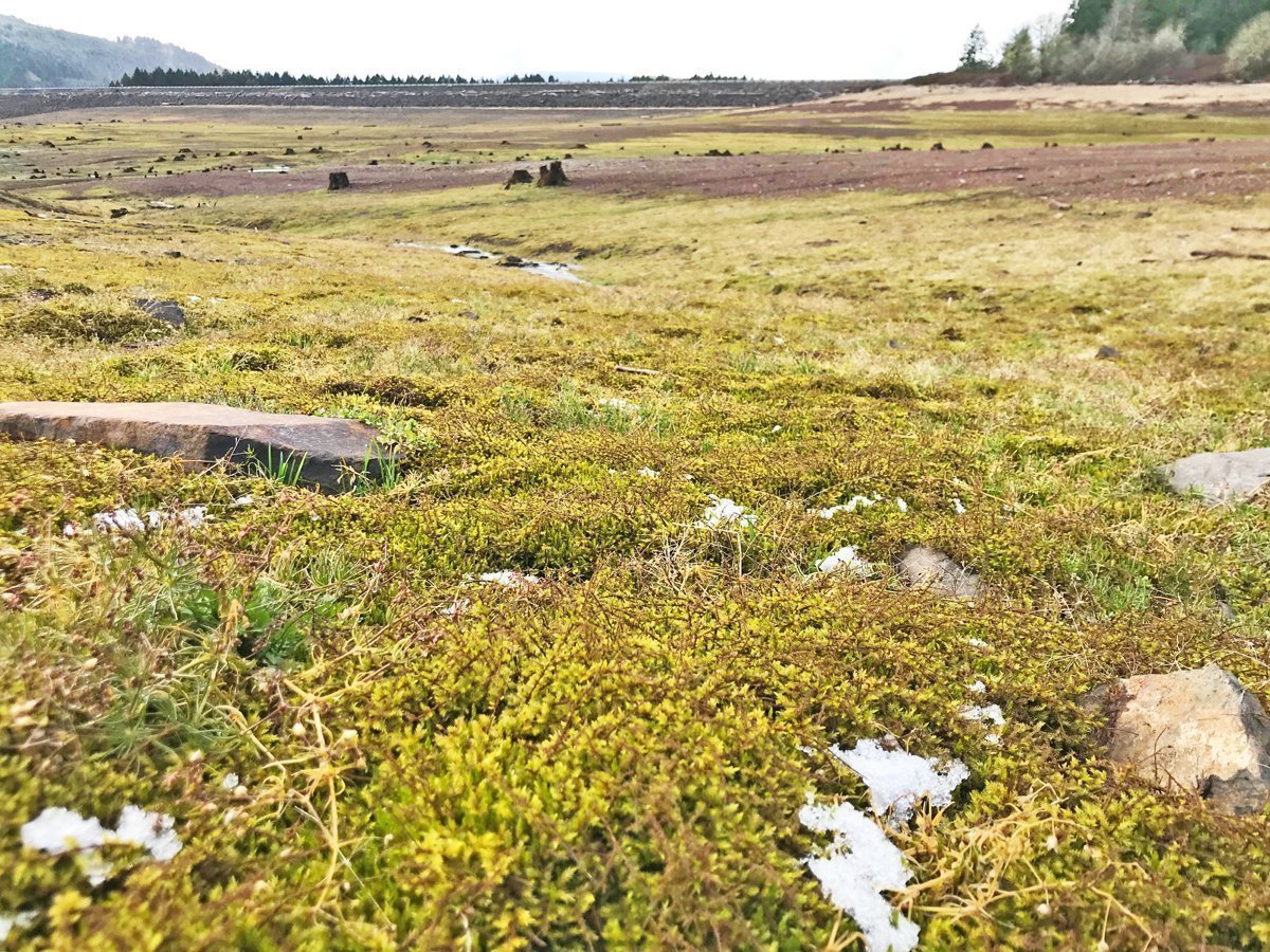
Leftover snow made our view perfect. It melted by the time we left only an hour later.
Fall Creek basin
As we walked deeper into the lake (such a weird thing to say, right?!) the landscape changed from grass and moss to rocks and stumps. This entire area was formerly a forest, and the stumps remain several decades later. Some of the stumps are from huge old-growth trees. My kids had a blast playing tag around them and jumping off of them.


The stumps have been alternately underwater and exposed to air for over 55 years. The changing conditions have carved them into individual works of art.

Finally, water!
We continued to follow the road down toward the water. The road took on more of a “road” look, and we could see white center striping. And next to the water…a parking lot. I’ve asked around online and I can’t find anyone who knows what the parking lot was for. Perhaps it was for the construction work while the dam was being built. Perhaps it was for recreational parking during periods of lake draw down. If you know, contact me or leave a comment below!
2022 Update: Sean Stewart, a ranger at Fall Creek Lake, explained more of the history and answered my questions:
The old road that serves as the low water ramp was a temporary road built to go around the dam while they were building it. It connected the old Fall Creek Rd down by the Unity Covered Bridge to the remaining road allowing folks to go around the dam. The parking lot is for a low water ramp. For many years, the lake was held at an elevation just below the parking lot so people could fish year-round. When the dam was finished, they also finished building Big Fall Creek Road, Winberry Road, and Peninsula Road so you could drive all the way around the lake. The old Fall Creek road is still visible at the bottom of the lake and meets the new road at Cascara Campground.

I assumed this was an access road–until we came across stripes. Then I easily imagined this before 1965, when this might have been a country highway winding through the forest. The road was absolutely ideal for hiking into the lake bottom with our kids.
At last, we reach the water. And…a parking lot?! It’s an ideal spot to park the stroller and let the little ones out to run around. Beware, we did find a lot of broken glass here.

Hopefully by summer, this will all be under water again.
Such beauty reflected in the water and in my camera lens. I was in awe of the richness of the many colors. I expected the lake to be brown and barren, but it was incredible.
What we found at the bottom of the lake
While I was oohing and aahing at the scenery, my kids were busy looking for treasure. We found plenty of tennis balls and litter (some of which we picked up, thanks to our commitment to leave it better than we found it). My husband found scores of rusted nails (did someone drop a bag of nails from their boat?) But we also found some crystalline rocks and some pretty awesome pieces of melted glass. Note: it is illegal to collect rocks and minerals at Fall Creek Lake (Article 327.14).
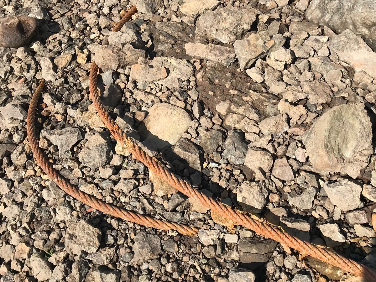
This is a common finding in forests, but not so much at the bottom of a lake. It’s a logging choker cable, used to drag logs uphill to the landing. I’ll bet this was left behind when the forest was logged prior to the dam construction.

When you toss a beer bottle into a very hot campfire, sometimes you’ll end up with these: chunks of melted glass. We found quite a few unique pieces, but brought this one home, just for fun.

The happiest litter we’ve ever found!
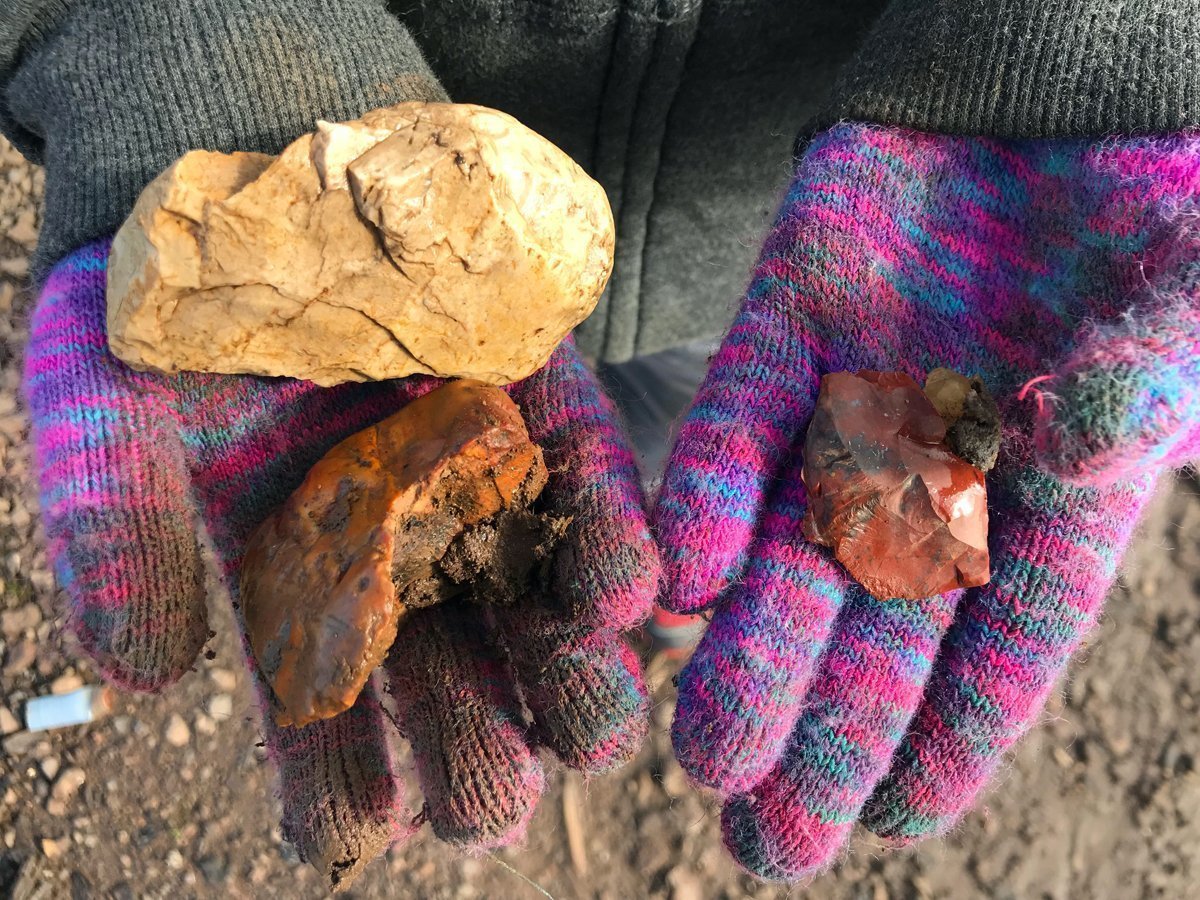
My kids found bits of quartz and jasper. The boulders at the bottom of the lake are crumbling into gravel, revealing interesting rocks and crystal formations. Note: it is illegal to collect rocks at Fall Creek Lake. Catch & release only! Take photos, not rocks!
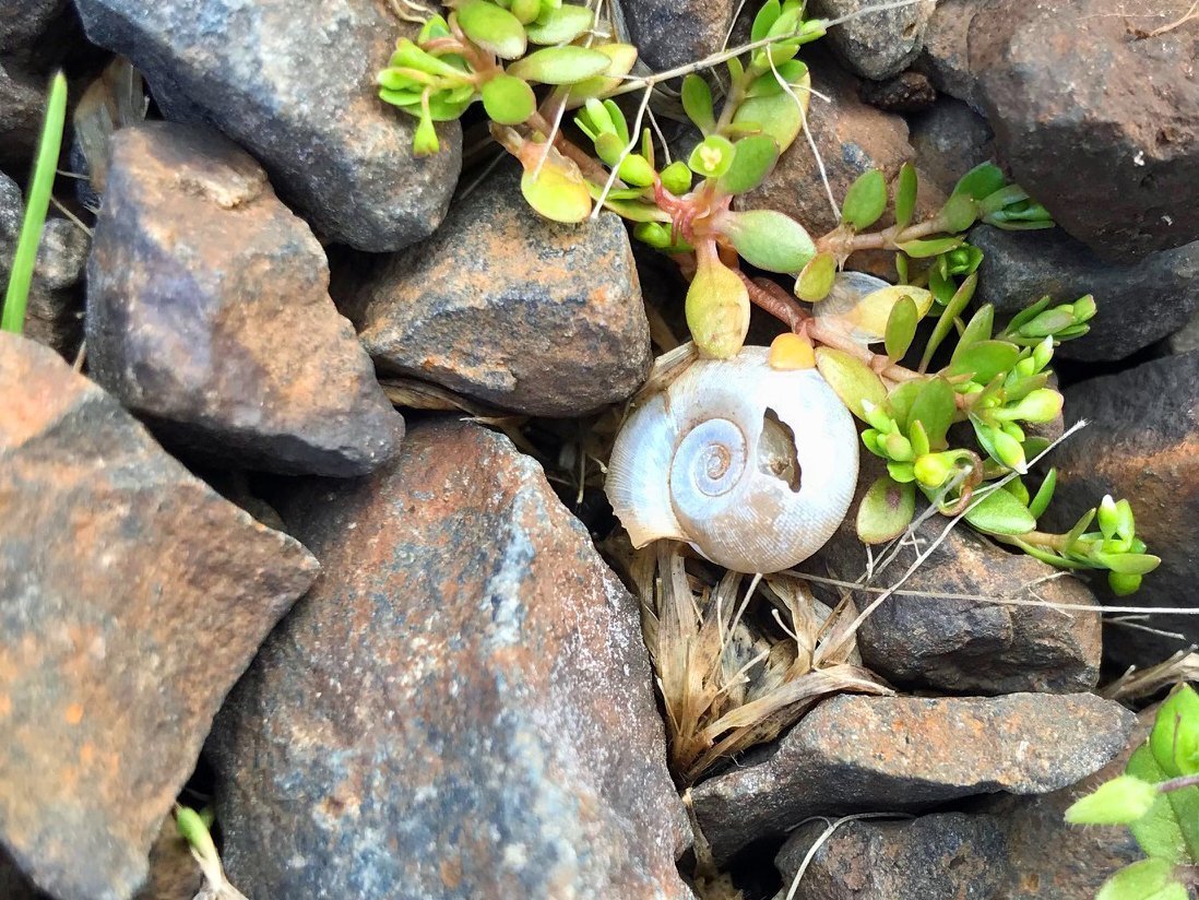
We even found a few tiny shells. These are about the size of a dime.
History of Fall Creek Lake
Fall Creek Dam was built in 1964-66 at a cost of $22 million. Primarily built for flood control, the dam is 205 feet high, and holds 125,000 acre-feet of water. The lake historically is filled to a depth of 160 feet. Each year, it’s drawn down to allow for flood control, but in 2011 the Army Corps released water all the way down to stream level for the salmon migration. In 2021, the U.S. District Court for the District of Oregon passed an injunction that affect water levels even more.
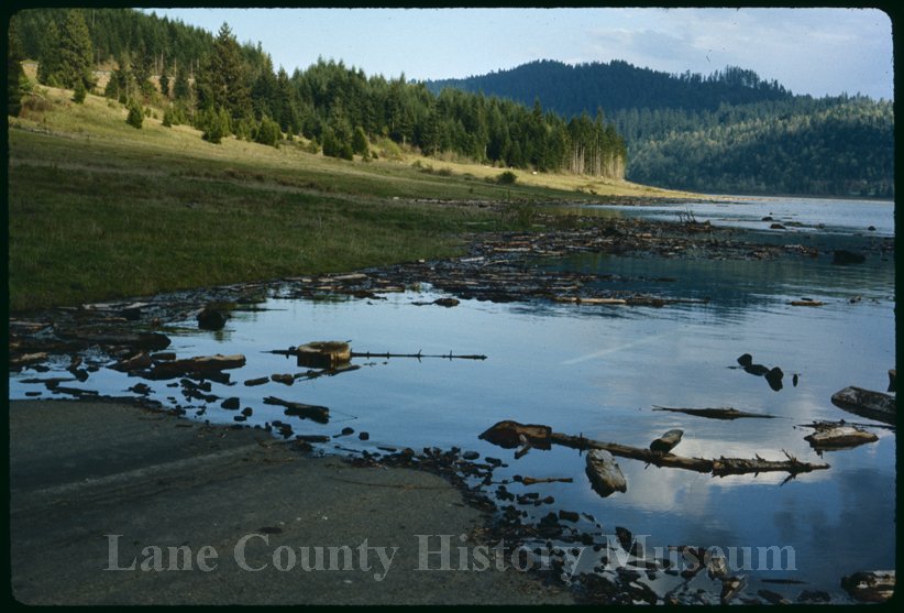
This photo from 1966 (by Don Hunter) shows the road we walked down, complete with white center stripes! Verification that this road wasn’t an access road, but a country highway. Photo used with permission by Lane County History Museum.

Now I have to go back and get this same photo view so we can compare! Don Hunter captured this photo in 1966, the first year the reservoir was filled. Photo used with permission of Lane County History Museum.
Edited to add: I’ve kept digging for information about this road, and I finally found it in some old maps. The road was part of a paved road system through the Fall Creek area and connected to the old Highway 58 (before it moved due to Dexter Lake). For your viewing pleasure…

A modern day topography map of the Fall Creek area shows the outline of the lake and nearby hilltops.

I found a 1935 map showing roads in the Fall Creek area. The line delineating sections (1 mile by 1 mile) obscures the road, but close inspection shows two roads meeting east of Unity School.

I used Photoshop to layer the modern day topo map on top of the 1935 map, allowing the old road to show through. By lining up the topography (hilltops and peaks) I could pinpoint that this old road is likely the same road that exists under the lake today.
If you go
If you go, and you really should, here are the details.
Fee during the winter: none
There are several entry points around the lake. We entered at the North Shore boat ramp. During the summer, there are vault toilets at this location (and on our visit, one toilet was open, to my relief).
- Latitude:43.945866
- Longitude:-122.765811
5 comments
Hi,
I’m a Park Ranger at Fall Creek Lake. The old road that serves as the low water ramp was a temporary road built to go around the dam while they were building it. It connected the old Fall Creek Rd down by the Unity Covered Bridge to the remaining road allowing folks to go around the dam. The parking lot is for a low water ramp. For many years, the lake was held at an elevation just below the parking lot so people could fish year round. When the dam was finished, they also finished building Big Fall Creek Road, Winberry Road, and Peninsula Road so you could drive all the way around the lake. The old Fall Creek road is still visible at the bottom of the lake and meets the new road at Cascara Campground. Glad you enjoyed your walk!
Wow, thank you so much for taking the time to comment! This is really helpful and I will update my post! I really enjoy learning the history of local places, and we visit Fall Creek Lake almost weekly.
Great post! I love the geological wonders our area has to offer and enjoy exploring with my dog, Scout. I see this was posted in May, but I am interested in going in the fall/winter. Do you know when the water is low enough to go to see the stumps and such down there? Thank you!
It’s usually low enough Dec-Feb. It might take a little longer this year because the lake was extra full this year. I haven’t been up there in a few weeks so I’m not sure what the current level looks like. Hiking down next to the dam on the Winberry side is neat, too, and a whole different experience than the North Shore side.
Thank you very much!!