
This post may contain links to products that we use and love, and we may earn a commission at no cost to you.
Salt Creek Falls is one of our favorite stops on Oregon’s Highway 58, which links the valley to Central Oregon over the Willamette Pass. It’s a great place for a quick rest or to spend a whole day.
Salt Creek Falls is on Highway 58, just east of the tunnel.
Salt Creek Falls is Oregon’s second-highest single drop waterfall at 286 feet. It’s also one of Oregon’s most powerful falls with an annual average of 50,000 gallons a minute plunging toward the pool below. The upper observation deck is 50 yards from the parking lot and is fully wheelchair accessible, with the entire falls visible.
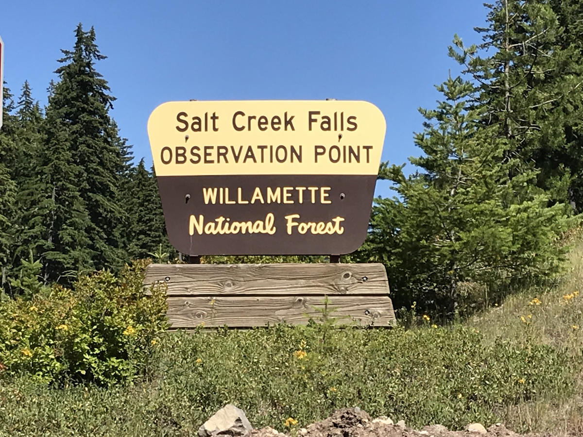
Trailhead at Salt Creek Falls
There’s one parking lot with developed restrooms. Off to the side are a few isolated parking spots; behind these, amongst the trees is a picnic area. Also note that there’s a $5 day use fee per vehicle. This is payable near the restroom. The Northwest Forest Pass and a variety of interagency passes are also accepted.

Salt Creek Falls
From the parking lot, several trails lead to the overlook. The deck is large enough to accommodate several groups of people. This viewpoint is entirely accessible.

Salt Creek Falls viewing platform, just a few yards off the parking lot.
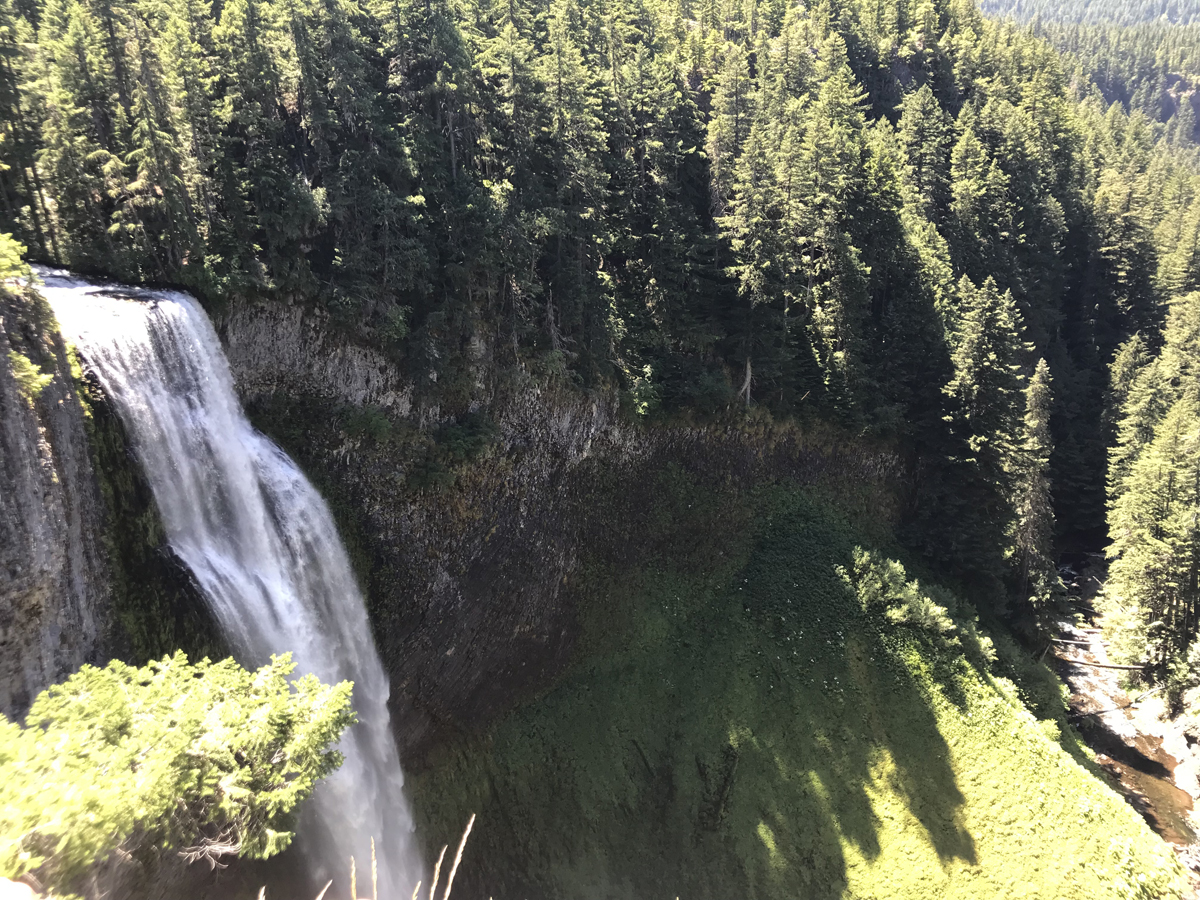
As you approach the railing, the vista opens before you. The trees spread out for miles in an endless sea of green. And the falls are suddenly visible, falling an astonishing distance to the unseen below. The roar of the falls is unmistakable, you can almost feel the pounding as the water hits the rocks.
 The path soon turns to stairs. The path beyond this point is not stroller-friendly, nor wheelchair accessible. Past the stairs is a dirt trail, bordered by a rustic wood fence. This trail leads to several viewpoints and goes almost to the bottom of the falls.
Salt Creek Falls Hike
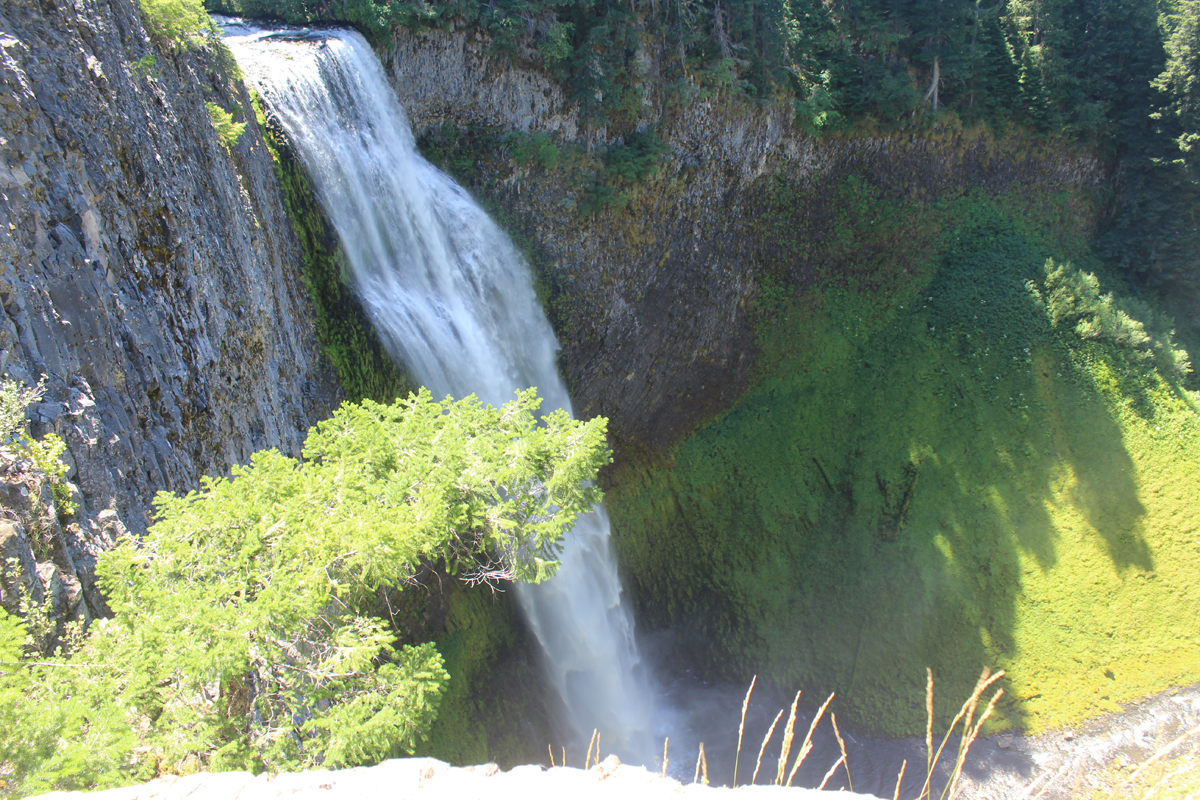
The entire trail is 0.6 miles down a twisting, switchback path. But near the top, perhaps 0.1 mile down, is a viewpoint that most ambulatory people will safely reach. This viewpoint has the best views. Caution for children and dogs…there’s only a sturdy wood fence and a long drop to the bottom. A stunning view is the reward, and we watched in awe as the water fell to a misty demise.

View from the “midpoint” deck on the trail.
Journey to the Canyon Bottom
We didn’t just want the best views, we wanted all the views, so our family trouped on down the trail, anxious to reach the bottom. After the trail was severely damaged by a winter storm, it has been completely rebuilt with a new deck near the bottom of the falls.
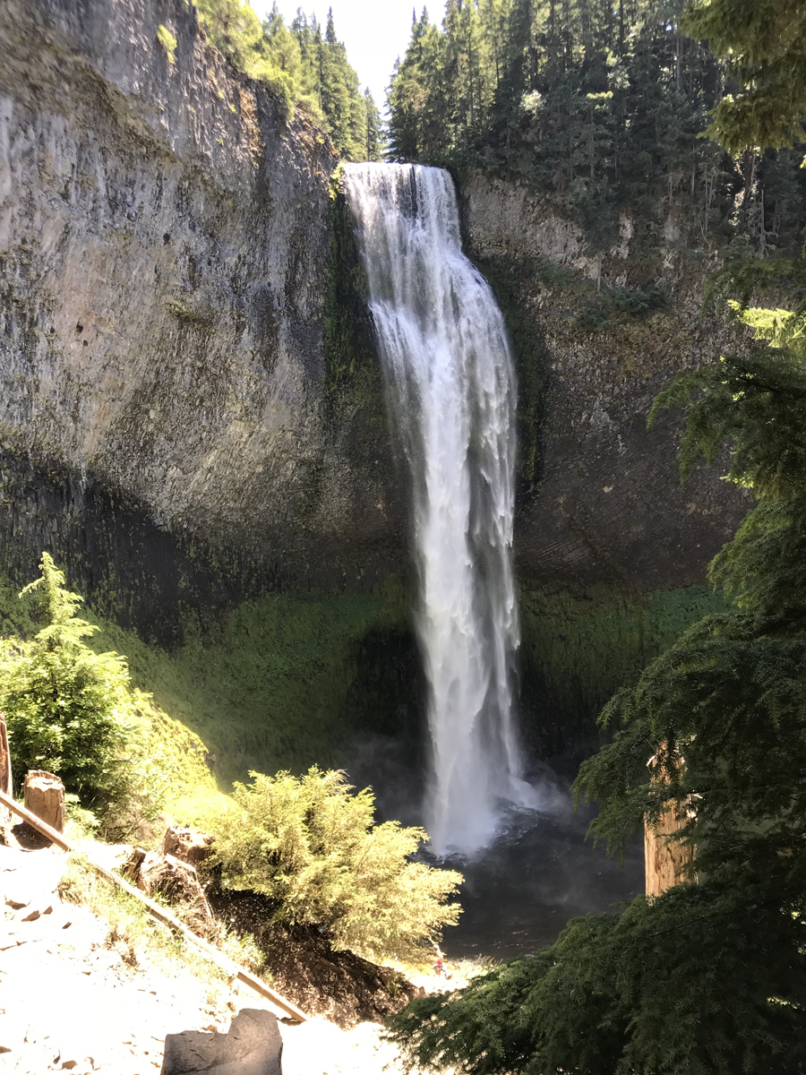
View from the bottom deck.
Our trail at an end, we carefully turned and headed back up the path. We stopped again at the viewpoint for a few selfies and a family photo, then headed back to the parking lot, where we discovered there was more to explore.
Picnic Area & more trails
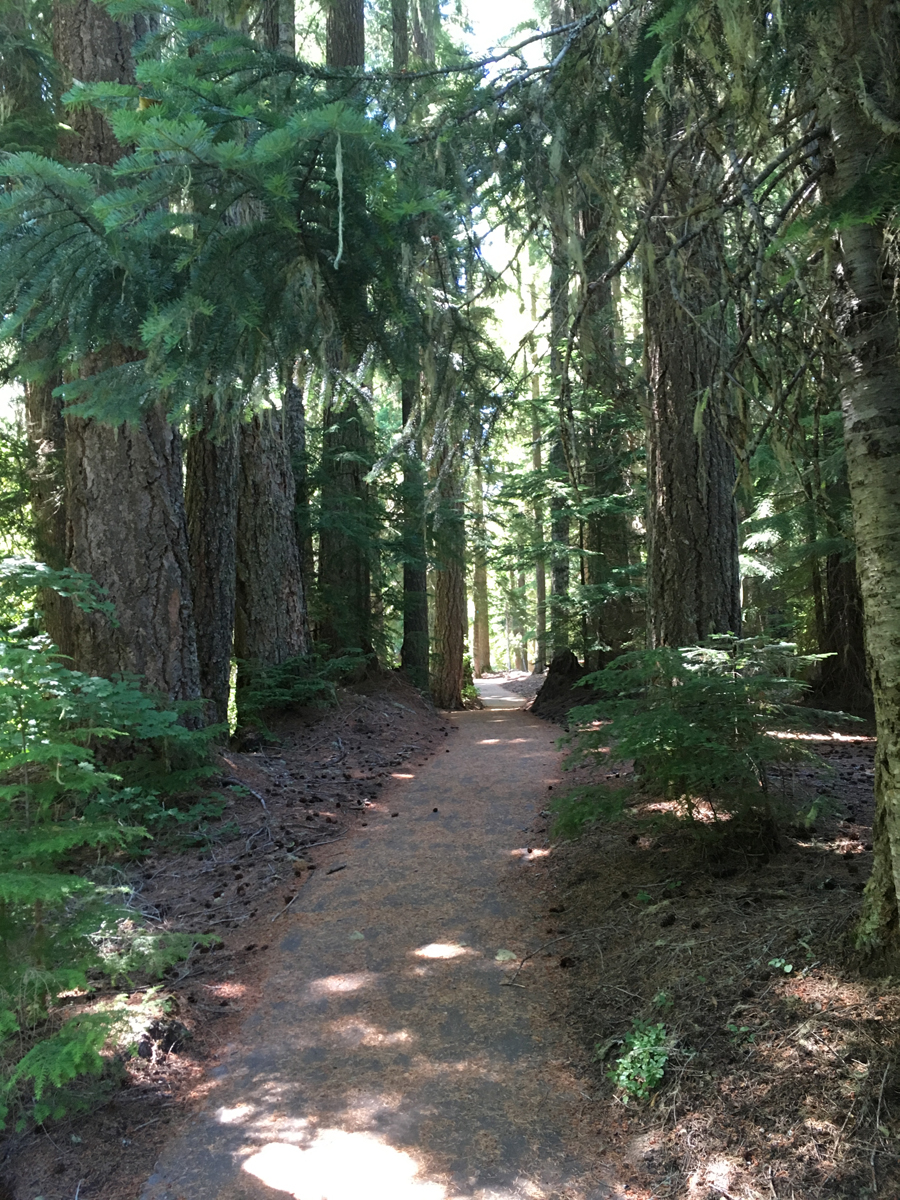
To the south side of the parking lot, there are a few parking spaces that are somewhat separated from the rest of the parking lot. There’s a trail leading to an entire picnic area complete with fire pits and picnic tables. This area is around the corner from the restrooms and main trailhead, but don’t miss it! Take the time to visit, because it’s more than just picnic tables. My husband took this photo as he said, “How do you see this and not go?”
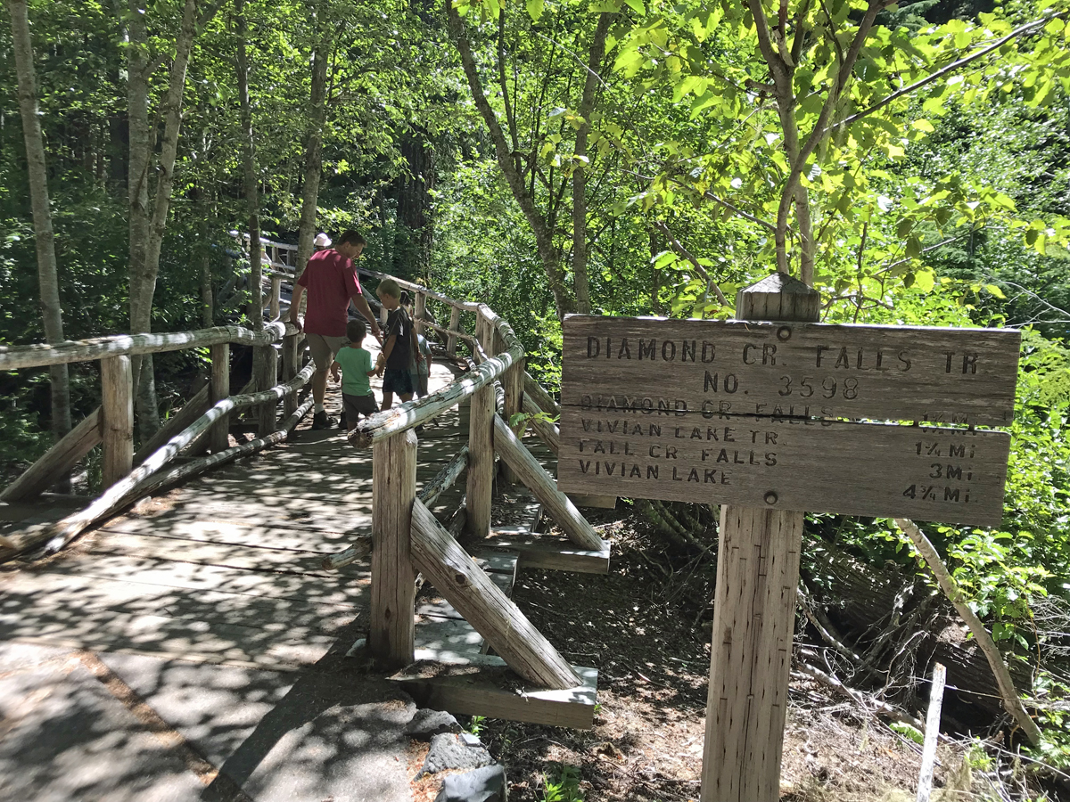
We’d stumbled onto the trailhead for Diamond Creek Falls. We weren’t prepared for a longer hike, so we only went as far as the bridge, which itself was fun to visit as it looked like a hobbit bridge.
If you go…
Salt Creek Falls is officially open during the summer. The parking lot is closed during the winter, but you can hike in or snowshoe in to see the falls, and they’re glorious during the winter.
As mentioned above, there is a picnic area, but it’s not obvious, nor where you’d expect it to be. Continue around the parking loop, past the bathroom, and there’s a small sign that has a picnic table. Park here, and take the trail through the brush. Once under the trees, there are lots of picnic tables, including some that are creekside.
The top of the trail is wheelchair- and stroller-accessible. The rest of the trail is not, but if you’re using a wheelchair or stroller, you can still see amazing views and the entire waterfall.
Bathrooms have flush toilets, but no other amenities. I’m not even sure it had a sink. My husband said the men’s room didn’t have doors on the stalls.
Parking is $5 per vehicle. America the Beautiful passes and forest recreation passes are accepted.
Directions: Salt Creek Falls Observation Site is 23 miles (37.015 km) southeast of Oakridge and approximately 5 miles (8.0467 km) west of Willamette Pass. From Hwy 58 look for the signs, turn onto FS Road 5893 and follow the signs.
History of Salt Creek Falls area
I can’t help it. I love history, so when I know a little bit, I have to share it! Plus, my daughter once told me she hates history. Challenge accepted.
According to a sign at the falls, Salt Creek Falls was formed during the last ice age as glaciers receded. Later lava flows and water helped to further carve and deepen the Salt Creek valley. Molala and Kalapuya people lived in the area as much as 7000 years ago, but the first recorded human sighting was by a Molala tribe member, Charles Tufti, and a Lane County settler, Frank S. Warner. They visited Salt Creek Falls together in March 1887.

Salt Creek Falls, date and photographer unknown, courtesy of Lane County Historical Museum. Notice the snow at the top and bottom of the falls. Photo used with permission.

A winter photo of Salt Creek Falls, taken by L. Parker on February 26, 1964. Photo courtesy of Lane County Historical Museum and used with permission.

Interpretive sign at present day Salt Creek Falls
In the 1930s, the Civilian Conservation Corps (CCC) camped in the area and built the rock walls and pillars that you can still see today on the observation deck. They were paid around $30 a month for their work, and they also improved or built many of the roads, trails, and bridges in the area.
Salt Creek Tunnel
The nearby Salt Creek Tunnel was built between 1938-1940. It was a major project that connected the Willamette Valley to central Oregon and was little more than a wagon road before the improvements were built. Even after the tunnel opened, the road was gravel until the mid-1960s.

Construction of the Salt Creek Tunnel on Highway 58 in 1939. The crane is lifting stones into place to build the east entrance. Photographer unknown, photo courtesy of Lane County Historical Museum.

To reach Salt Creek Falls from Eugene, you’ll pass through this tunnel, which exists today and was refurbished in 2015. Photo date 1940, courtesy of Oregon Department of Transportation.
2 comments
Thank you so much for the info and stunning pictures of Salt Creek Falls. Do you have a Facebook page or are you on YouTube?
Thank you so much! I’m on Facebook at https://www.facebook.com/oregonoutdoorfamily/ and on Youtube at https://www.youtube.com/channel/UCDzRXpCKJH0HNVzQcZkihmg (not much on Youtube, though, mostly just hosting short videos that we use in our blog posts).